Digitally transforming information assets
for operational excellence
for operational excellence


Geologix’s software technology is key to unlocking actionable insights that drive safe and efficient wells
Whether you’re operating Hydrocarbon, Geothermal, Lithium or Helium wells, decommissioning or repurposing for Carbon Capture, you’ll be able to execute a range of subsurface workflows
From well planning, through remote monitoring of your project, post well analysis and reporting, operators and service companies around the world choose Geologix as an integral part of efficient and safe well delivery
Clients and Partners

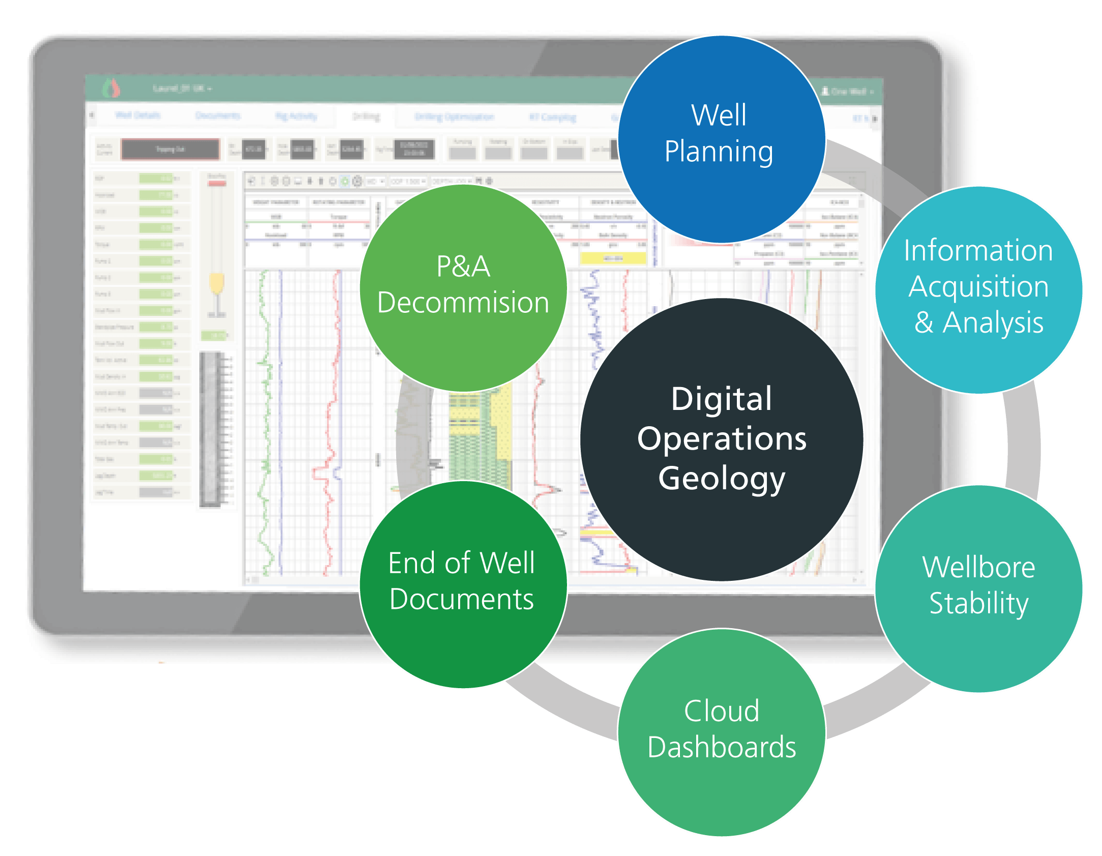
Leaders in Digital Operations Geology
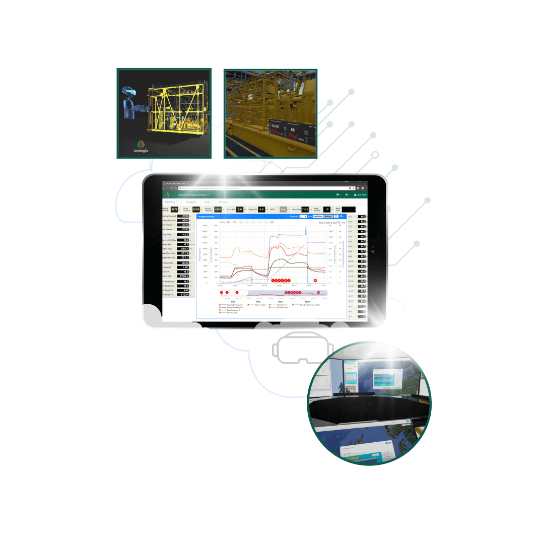
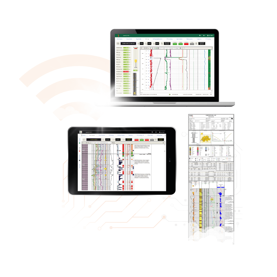
From planning to completions, capturing knowledge for robust decision making is easy and fast. Our world-class well operations system allows for immediate transmission of analyses and interpretation for holistic and rapid decision making that saves time and money.
Connecting you to your operation contractors, partners and government regulators is effortlessly managed in the cloud.
Our unique Cloud Complog™ brings LWD and geological information together for instant review on any connected device.

Geothermal
Our technology has been deployed in the Far East to allow geothermal well operators to remotely monitor their drilling projects, allowing experts to make quality, on-time decisions

Helium
Helium exploration drilling operations in Africa are utilising Geologix software to track well progress, interpret subsurface geology and analyse the presence of Helium gas

Lithium
Our Operations Geology Software, traditionally used for hydrocarbon wells, is deployed on Lithium brine extraction projects in South America for the worldwide battery industry
The Geologix Way
Customers, but also Partners.
We’re part of your journey, to support and adapt to the dynamic needs of your projects as they evolve.
We take time to understand your desired operational outcomes, the value they have to the project…and the people involved.
We’re committed to providing software applications and services that deliver across disciplines in a full-stack approach.
Sign up for a Geologix Account
Get access to free product downloads, curated content and publications.
Geologix customers can also request access to the latest licensed product downloads like GEO and GEOLogger. Coming soon is a rich user knowledge area for self service support in our Customer Portal.
Follow us on social media
Keep up to date with news, events and behind the scenes across our platforms