Pipeline Mapping
Pipeline Mapping

Integrity management, optimization of pipeline operation and pipeline data sharing across all stakeholders.

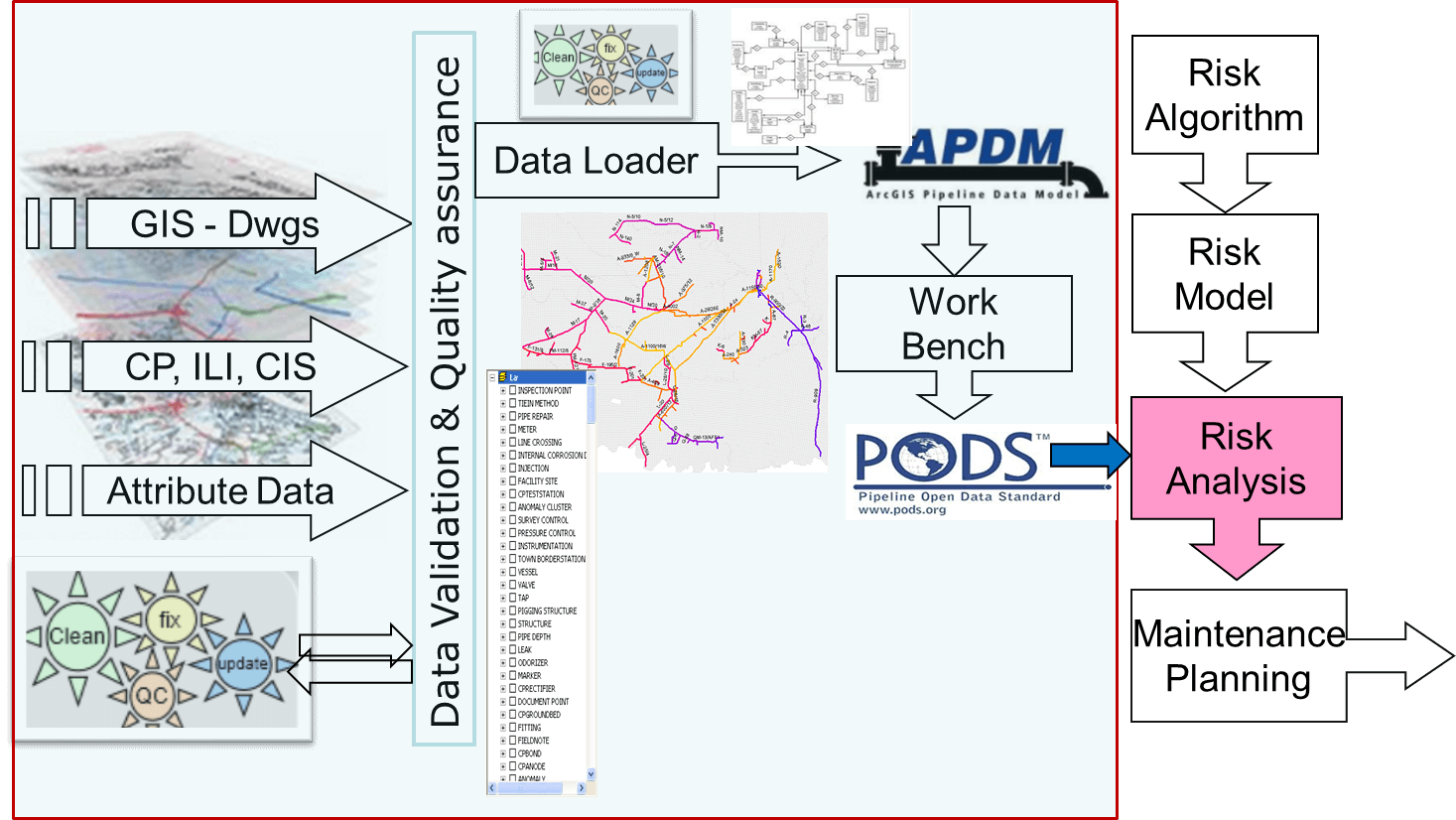
Why do you need a data model?

A fully integrated pipeline data model optimises the value of all the data available from numerous sources and formats in order to maximise the value of that data for all stakeholders. Without an integrated model, the data remains fragmented, lacking QC and of far less use or value to decision-makers.

In addition, a fully integrated data model reduces safety risks and optimises project schedules, both internally and between agencies, enabling good risk management and real-time updates across the project.

Typical Project Scope

Why choose Geologix?

Geologix Limited is able to build an integrated Pipeline Data model, representing all onshore pipelines in a GIS model, including existing and planned projects in a given area. This provides interoperability between the corporate data repository and other departments, including urban planning, department of transport, environment agencies and the government.


The model includes all flow lines, wells, transfer lines, utilities, land-use and MOL, and other existing data types and facilities required by partner companies.

For a discussion on how we can support your pipeline integrity objectives, please contact your nearest Geologix office.

Find out more about
Integrated Software Services

Discover what workflows and features you need

contact